

About Kalindi Khal
Set at an altitude of 5,947 meters, the Kalindikhal Pass on the base
of Kalindi Peak, which is at an elevation of 6,102 meters, and
surrounded by several other snow clad mountains is the world's highest
trekkable mountain pass. The journey en route Kalindikhal Pass unfolds
some of the majestic peaks of the Indian Himalayan range. From the
cluster of 6 thousanders, the Shivling at 6,543 meters, Meru at 6,630
meters, Kedar Dome at 6,808 meters, Bhagirathi I, II and III at 6,512
meters, 6,454 meters and 6,856 meter respectively, Nilkantha at 6,506
meters, Chandra Parvat at 6,728 meters and Avalanche Peak at 6,413
meters are some of the prominent ones along the trek to Kalindikhal
Pass. From the group of 7 thousanders, the Mt. Kamet at 7,756 meters,
Mt. Mana at 7,272 meters and Abi Gamin at 7,355 meters are visible
during a bright sunny day. Further, the trail cuts through several small
gushing streams and passes through the alpine meadows and forest
enriched with wide range of Himalayan trees and varied species of
Himalayan animals and birds. Finally a steep climb leads to dangerous
glaciers, which are above 5,000 meters in height like the Suryala Bamak
and Sweta. The trek to Kalindikhal Pass also covers some of the high
altitude lakes of India, the Vasuki Tal at 4,800 meters approximately
and Arwa Tal at 3,910 meters. The Kalindikhal Pass trek, which is one of
the toughest treks in the Indian Himalayan belt, located in the Garhwal
Himalaya, requires acclimatization and prior high altitude trekking
experience. Most of the trail goes through a thick bed of snow and cuts
through several glaciated and narrow tracks. The trek involves the use
of ice axe, crampons and fixed rope and thus it is one of the
adventurous journeys in the Garhwal Himalayan region.
Area : Garhwal Himalayas
Duration : 18 Days (6 days travel and 12 days trekking)
Best Season : Mid June – August- Early September
Grade :Tough
Altitude : 5946 m/19500 ft
Total Trekking : 100 K.M
The Kalindikhal Pass trek commences from the Bhagirathi Valley, from
an altitude of 3,048 meters at Gangotri, which is one of the major Hindu
pilgrimage sites. From Gangotri the trail leads to Bhojbasa, which is
at an elevation of 3,792 meters, cutting through a thick alpine bed
dotted with wide range of Himalayan trees. Thereafter the trail snakes
through the rocky terrain to reach Gaumukh at 3,890 meters. Gaumukh is
the mouth of the Gangotri Glacier and the origin point of River Ganga.
From Gaumukh the trail winds upward to Tapovan, one of the high altitude
meadows at an elevation of 4,463 meters and is a picture perfect
campsite with the Bhagirathi group of peaks at the backdrop with
crisscrossed bubbling streams and dotted with wild flowers. Herds of
Bharal (blue mountain goats) are a common sight from here on steep
mountain edges. From Tapovan, the journey continues towards Vasuki Tal
via Nandanvan, cutting through the glaciated tracks of Chaturangi and
glimpse of Meru and Bhrigupanth. From Vasuki Tal the trail starts
further strenuous as it steps on to the thick bed of snow and heads to
Suralya Bamak at 5,480 meters followed by Sweta at 5,500 meters.
Thereafter a gradual climb to Kalindi Base and thence further upward
climb to the summit of Kalindi. The downhill trail follows to Arwa Tal
at 3,910 meters and thereafter leads off at Mana village via Ghastoli.
The Kalindi Pass trekking tour later wheels to Rishikesh enroute
Badrinath.
Kalindi Khal Tour Highlights
- Get an opportunity to visit prime Hindu pilgrimage sites like Gangotri and Badrinath
- Savour sights of lofty Himalayan Mountain Peaks like Bhagirathi, Shivling, Bhrigu Parbat
- Climb up along the hulking high Chaturangi Glacier
- Witness the beauty of alpine lakes and lose yourself in its serenity
- Add to your record, the scaling of 6000m Himalayan Pass
- Witness the gorgeous meadows of Tapovan and the origin point of River Ganga, Gaumukh
Best Time to Visit
Best time to travel to Kalindikhal trek between summers (mid June) and Monsoon (July to early September).
Summers: The weather of Kalindikhal Trek remains
pleasant during summers. The Himalayas are distinctly visible and the
cool breeze adds charm to the ambiance.
Monsoon: The rainfall enhances the beauty of the
trek. The forest and meadows become lush green and the flowers outgrow
in number. The weather remains moderate and pleasant.
Important Note:
- The best time for this trek is between Mid June to Early September
- The inner line permit is a must for touring in this region.
- Permit will be issued from District Forest Officer (DFO) Uttarkashi & District Magistrate (DM) Uttarkashi.
- The copy of the permit, list of the trekkers and guide, cook & porters and the photos should is verified by District Administration of Chamoli (DM of the district and SDM of Joshimath) as well as In Charge of the ITBP camp at Ghastoli as after Gangotri that is the only human settlement.
- All Trekkers, Guide, Porters, Cook & Helper also go through medical tests
- All trekkers, Guide, Porters, cook & Helper must be insured
- All Trekkers, Guide, Porters, Cook & Helper must be well equipped with the adventure gear like tents, sleeping bag, snow shoes, gloves, rain proof jacket etc.
- Carrying of Identity card is mandatory
- Book the trek with registered organizations only
How to Reach Kalindi Khal?
By Air: The nearest airport for Kalindi Khal airport is Jolly Grant in Dehradun. The airport is 215kms away from Uttarkashi.
By Rail: Haridwar and Rishikesh are the nearest
railway stations for Kalindi Khal Trek. From here taxi/cabs are
available for Uttarkhashi and further destination.
By Road: Uttarkashi can be reached from
Haridwar/Rishikesh by direct busses or shared jeeps. It takes about 6 - 7
hours to reach. Buses are available from early morning, and it is
advised you leave early to reach early or to give yourself contingency
time on mountain roads.
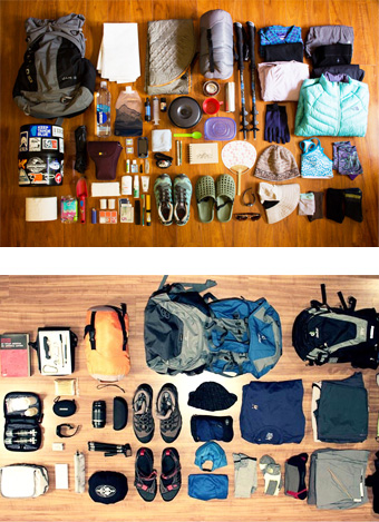
Things to Carry for Kalindikhal Pass Trek
- Sun Hat, Woolen Cap
- Head torch/torch, spare batteries/bulbs, light stick
- Neckerchief, sunglasses, sun block lip balm.
- Thermal vest, Fleece, Down jacket
- Gortex Jacket/Trousers
- Windproof smock
- T-shirts, Gloves
- A complete set of clothes to keep for changing into during evening (keep dry)
- Base camp shoes/trainers
- Trek Trousers, Shorts, Socks, Underwear
- Boots / gaiters, spare laces, waterproof cream
- Sleeping bag / liner
- Walking pole
- Waterproof liner (rucksack), Water proof cover (rucksack)
- Compass
- Crampon
- Short sealing
Kalindi Khal Trek (Detailed Itinerary)
Day 01: Delhi – Haridwar – Rishikesh
In the morning, take an AC train for Haridwar at 06:50 hrs. After arriving in Haridwar, meet our representative who will help you transfer to Rishikesh and check into your hotel. Evening time is free for leisure activities. Overnight stay at the hotel.Day 02: Rishikesh – Uttarkashi (170 kms/ 5 -6 hrs)
After the breakfast, we will proceed for Uttarkashi (1150 mts), which takes about 5-6 hrs. Upon arrival, check-in at the hotel. Post lunch, we will visit NIM (Nehru Institute of Mountaineering) Institute & Museum. Later, come back to hotel. Overnight at hotel.Day 03: Uttarkashi
Today, we shall spare a day for medical test, permit verification and visit to Nehru Institute of Mountaineering (NIM) etc. Overnight at hotel.Day 04: Uttarkashi - Gangotri (3048 m/10,000 ft) Drive (100 kms/4-5 hrs)
Post breakfast, we will drive to Gangotri via Harsil (approx 25 km before Gangotri (3048 mts) in 4-5 hrs. On arrival, check into Hotel/Guest house. Overnight stay in the hotel.Day 05: Gangotri – Bhojwassa (3792 m/12440 ft) Trek (14 kms /5-6 hrs).
In the morning, we will make you meet our trekking crew. Later, after the breakfast, we shall begin our first day trek, which will be to Bhojwassa. The trail is along the river Bhagirathi. Upon arrival at Bhojwassa, we shall set our camp for overnight stay.Day 06: Bhojwassa - Gomukh (3890 mts/12760 ft) - Tapovan (4463 mts / 14640 ft)
Early in the morning, you will get an opportunity to enjoy the panoramic view of Bhagirathi group of peaks. Post breakfast, we shall trek to Gomukh (3890mt), the source of the Ganges. From Gomukh, we will trek to Tapovan, from where a steep ascent begins. Arrive Tapovan and pitch tents. Dinner and overnight stay in camp.Day 07: Tapovan - Nandanvan (Trek 4-5 hrs)
We will trek to Nandanvan today. Dinner and overnight stay in tents.Day 08: Nandanvan – Vasuki Tal (4880 m/16000 ft) Trek (6 kms / 4-5 hrs).
We shall trek along with Chaturangi Glacier to reach Vasuki Tal today. Vasuki Tal is an alpine lake and is a base for Mt Satopanth and Mt Vasuki Parbat. The trek is steady and upward. It will take around 5-6 hours to reach Vasuki Tal. Overnight stay in tents.Day 09: Vasuki Tal – Khara Pathar (Suralya Bamak) (5480 m/17975 ft) Trek (6 kms/3-4 hrs).
Post breakfast, start trekking to Suraiaya Bamak (Khara Pathar) with packed lunch. Dinner and overnight in camp. Camping on MoraineDay 10: Khara Pathar – Sweta Glacier (8 kms / 4-5 hrs).
After the breakfast today, we shall trek 10 Km to reach Sweta Glacier (5500 mts). Dinner and overnight stay in the camp.Day 11: Sweta Glacier - Kalindikhal Base
After having the breakfast, we will set out for Kalindikhal camp. Overnight stay in tent.Day 12: Kalindi Base – Kalindi Peak
In the morning, we shall set out for Kalindi peak summit. Overnight stay in tent.Day 13: Kalindikhal - Raja Parav (4910 m/16105 ft) Trek (12 kms / 6-7 hrs).
After the breakfast, we will proceed to Kalindi Pass (5947 mts). Spend some time at the spot and then trek down to Raj Parav for dinner and overnight stay in the camp.Day 14: Raja Parav - Arwa Tal
Today, we shall proceed towards Arwa Tal (3910 mts), which is 13 km from Raj Parav. Overnight stay in the camp.Day 15: Arwa Tal – Ghastoli (3796 m/12450 ft) Trek (16 kms / 5-6 hrs).
Our trekking will be towards Ghastoli (3796 km) today, which is 16 Km from Arwa Tal. Dinner and overnight stay in the camp.Day 16: Ghastoli - Mana – Badrinath (3096 m/10155 ft) Trek (18 kms / 5-6 hrs).
Today, we will trek to Badrinath, which is situated on the bank of Alaknanda River. A seven-hour walk brings you to Mana Village, the last village of India. After having lunch here, we will drive to the town of Badrinath. On arrival, check into the hotel. In the afternoon visit the temple of Badrinath. Return to hotel for dinner and overnight stay.Day 17: Badrinath – Rishikesh
After the breakfast, drive (290 km) down to Rishikesh. On arrival, check-in to the hotel. In the evening, visit Laxman Jhula, Thirteen storied temple, Geeta Ashram, Parmarth Niketan and later join the Aarti ceremony at Triveni Ghat. Return to the hotel for overnight stay.Day 18: Rishikesh - Delhi (225 kms)
In the morning, transfer to Haridwar Railway Station and from here catch AC train for Delhi at 06:30 hrs. Arrival at Delhi by 11:45 hrs.Tour & Services End.
Fixed Departure Dates 2018
| 22 June, 2018 | 13 July, 2018 | 24 August, 2018 |
| 07 September, 2018 |


